Forestry Aerial Survey, Mapping and Drone Services
Drone based surveys for forestry by Angus Mackie, FICFor
Drones, or Unmanned Aerial Vehicles (UAVs), are extremely versatile with potential for surveying and mapping in forestry. Drones can successfully be integrated into workflows for most types of woodland survey, photogrammetry, 3D mapping and topographic surveying - as well as more specialist applications.
There is considerable scope for the use of drones in forestry, particularly for survey and inventory work. Drones can cover larger areas of ground quickly and in detail, often reaching otherwise inaccessible locations. There are not only savings in time and cost but there is a significant reduction in the need to physically access hazardous or difficult to reach locations.
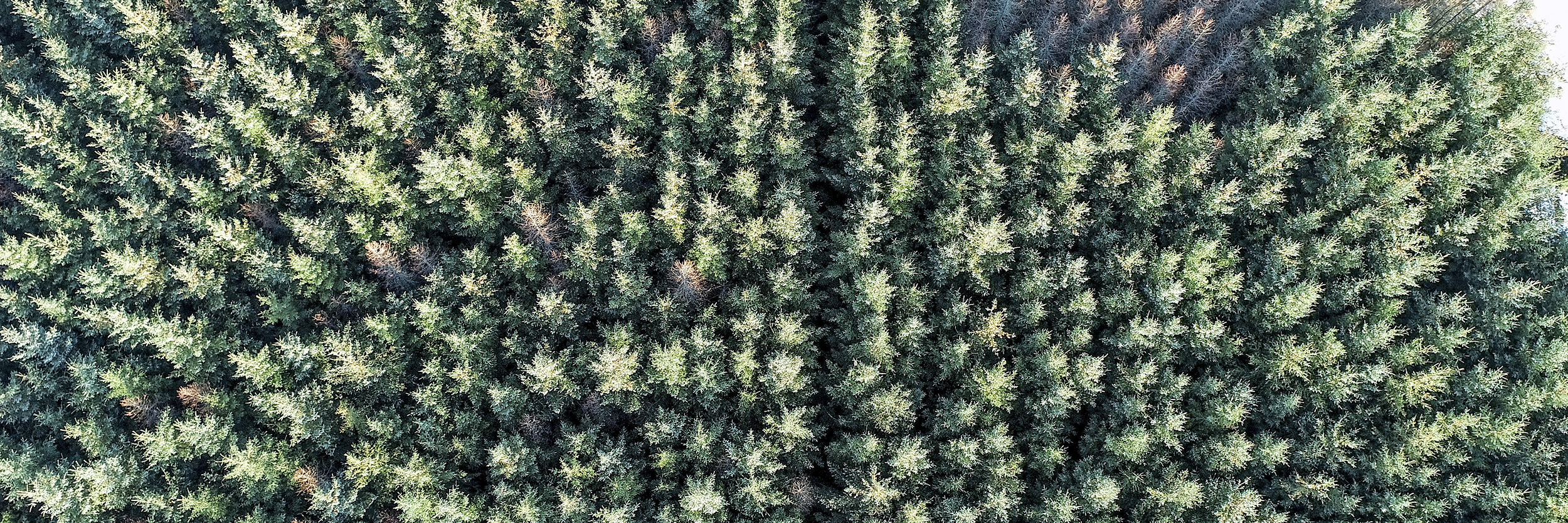
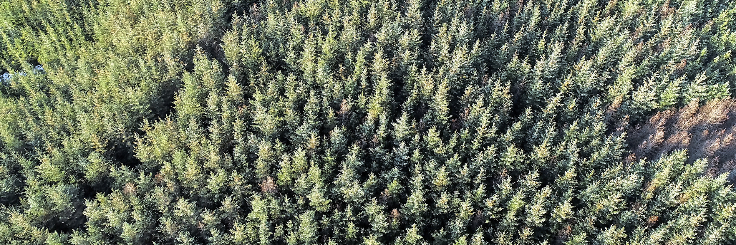
Sensors for drones, applicable for forestry use, include optical (photography and video) thermal and LiDAR. Optical sensors currently provide the most versatility and cost-effective data capture, now largely replacing the need for commissioning expensive, aircraft based aerial photography. The resolution from survey grade drones provides a level of detail more than adequate for forestry surveys. In addition, using the GPS co-ordinates stored by the drone allows for highly accurate surveys and the production of orthorectified photography for use in Geographic Information Systems (GIS).
Capturing drone photography is only the start of the process. The real benefits of drone survey are in extracting the added value from the data. Supplying final survey and interpretation outputs which are compatible with GIS allows for seamless update of mapping and inventory records.
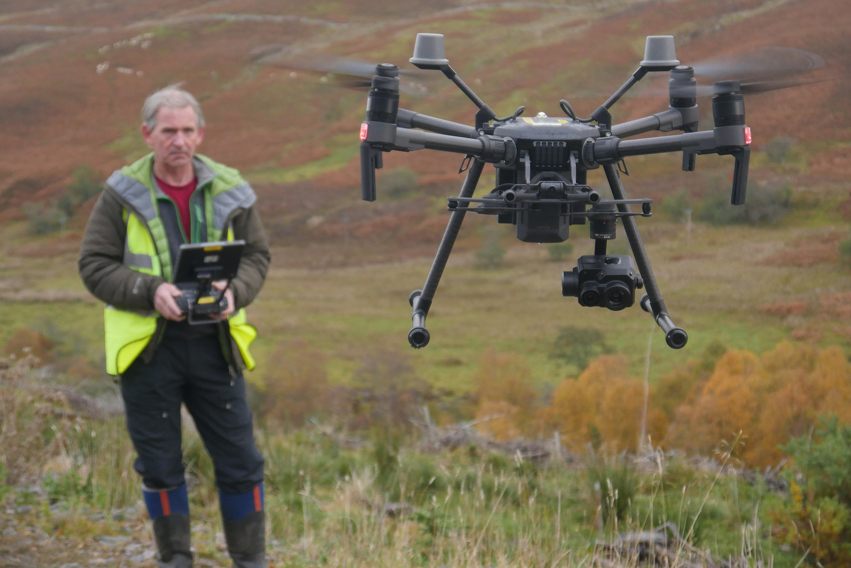
I’m a Chartered Forester and CAA approved commercial drone pilot who not only has has considerable experience in flying drones but who also has expertise in the application of technology to forestry surveys. With 40 years of wide ranging experience in forestry, my background includes many years of using, managing and developing Geographic Information Systems for large scale forestry management.
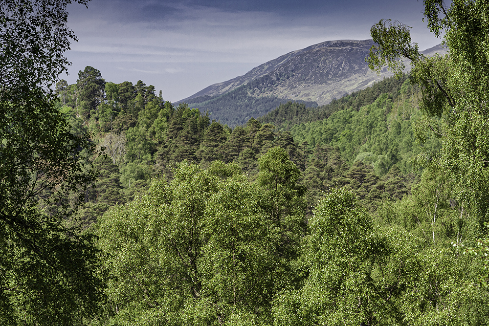
Based on the Black Isle, I'm well placed for the Scottish Highlands, whilst also providing services across Scotland.
From planning to capture and from interpretation to data supply, I can add substantial value to photogrammetric surveys, supplying mapping, interpretation and analysis services. Survey outputs and interpretation can be delivered as fully attributed GIS shapefiles.
My workflows and methodologies don’t use cloud based, subscription services. This approach allows for a more controlled, adaptable workflow with the added advantages of cost effectiveness and a much wider range of outputs, appropriate to the required end use.
Drone Survey Services and Outputs
My aerial survey services include:
Pre purchase fly over surveys Ground preparation inspection and reporting Woodland survey Windblow surveys Tree health and condition surveys Crop inspection Roadline surveys Landscape interpretation Still photography and video for sales and marketing
Survey outputs include:
Orthorectified, georeferenced and fully mosaiced aerial images for survey and interpretation Integration of aerial photography within GIS software Survey interpretation and inventory updates with output supplied in GIS format GIS mapping updates for forestry operations Oblique photography for presentation purposes Large scale 360° panoramic photography and virtual tours of sites, woodlands and estates Edited videos for presentation and interpretation 3D modelling
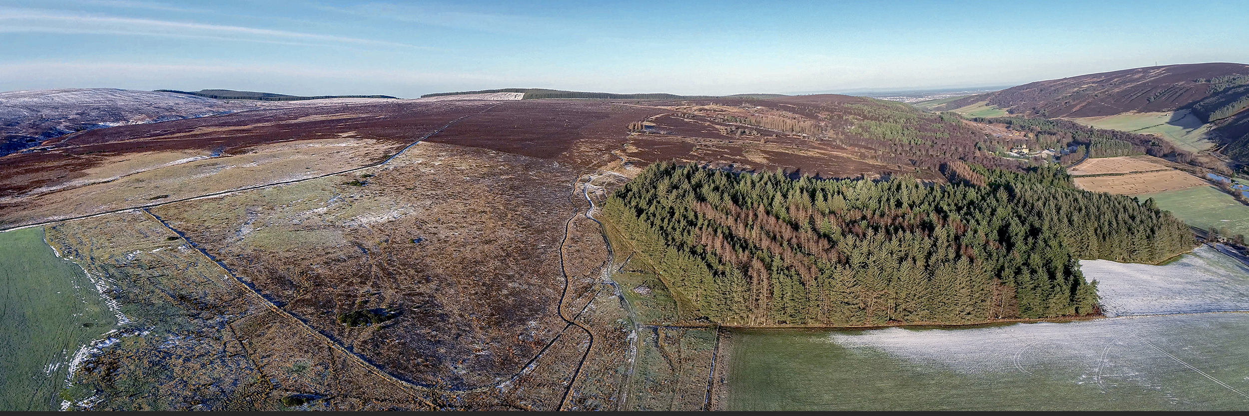
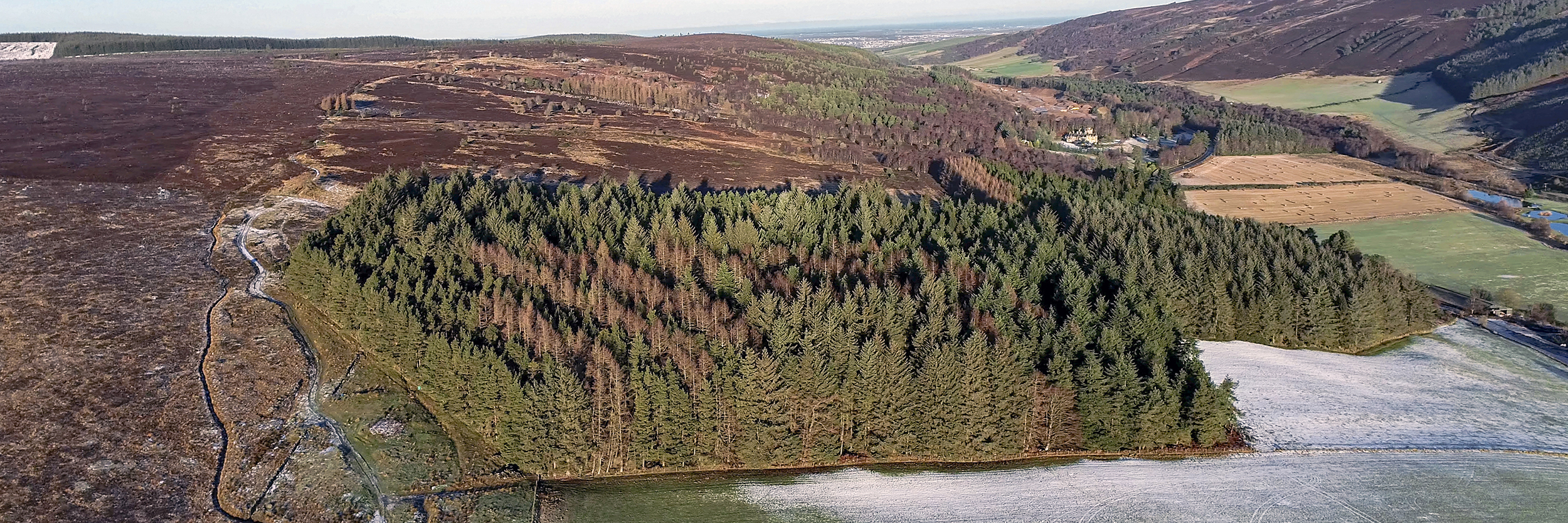
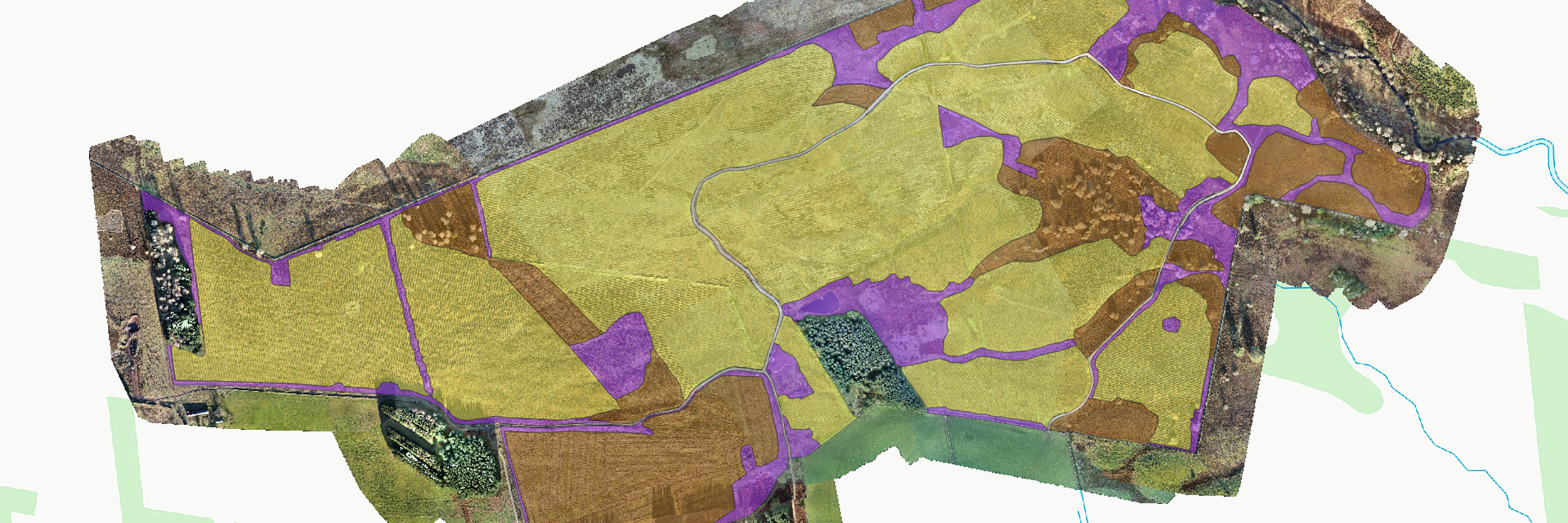
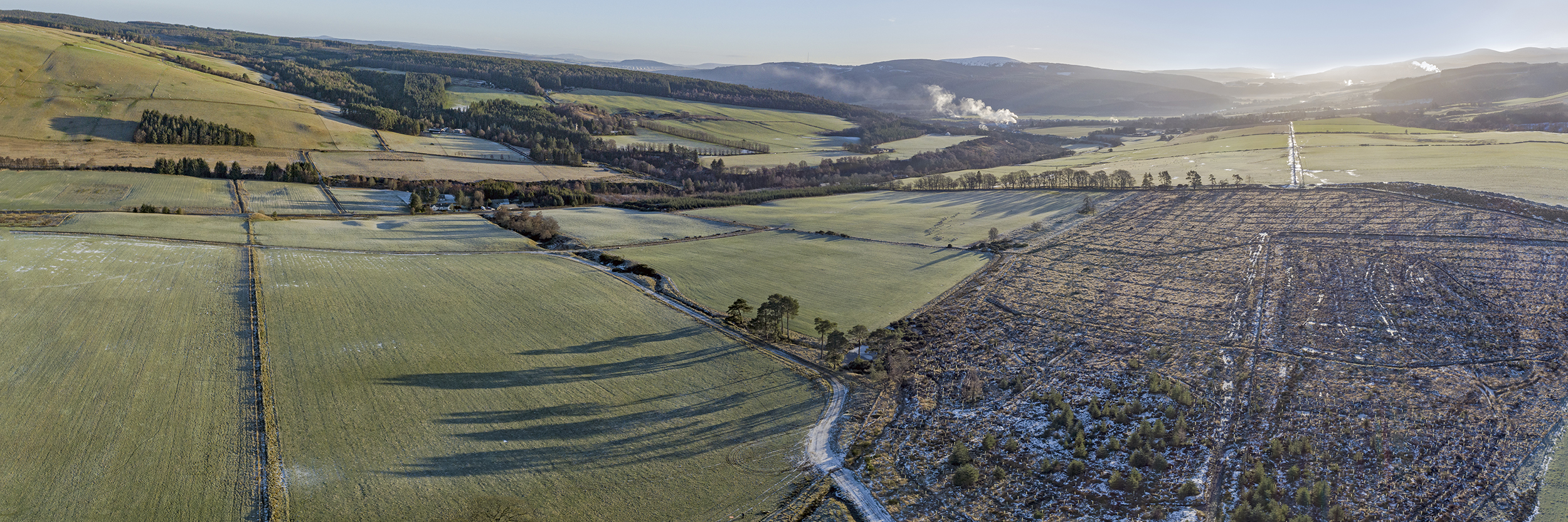
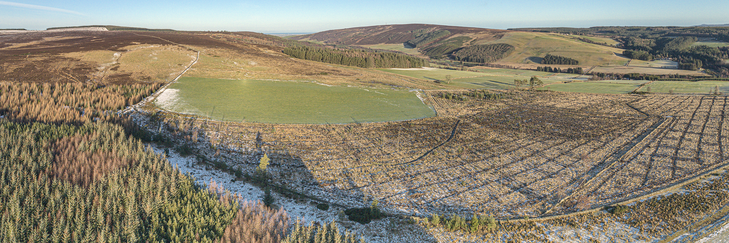
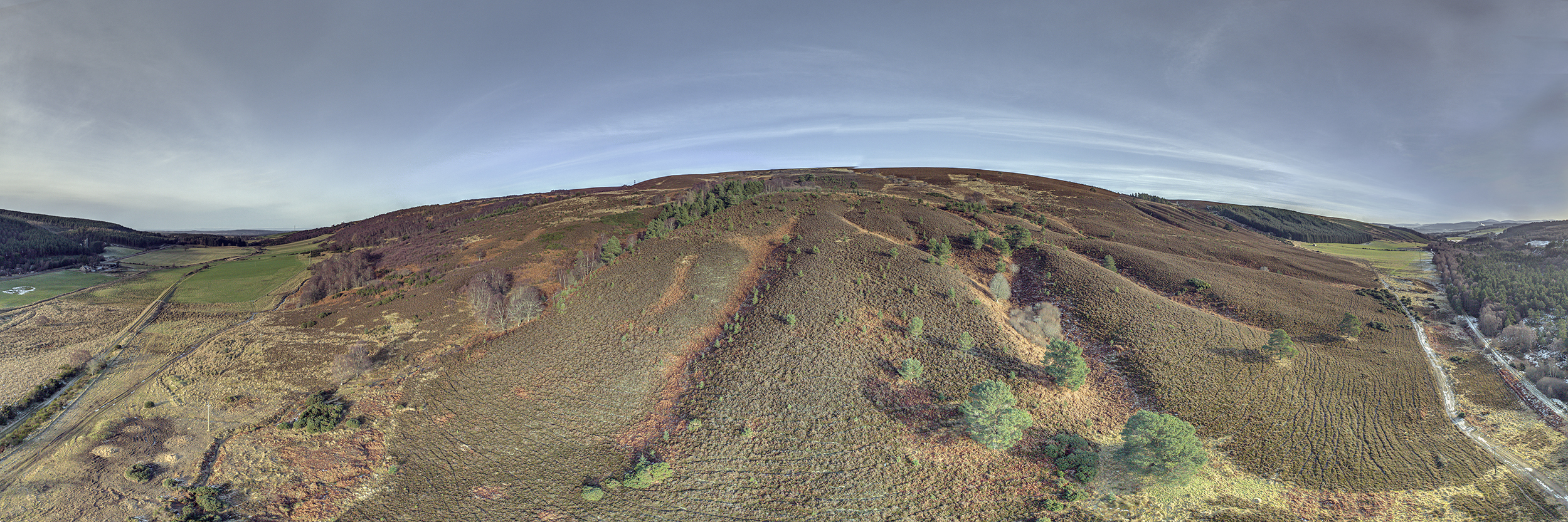
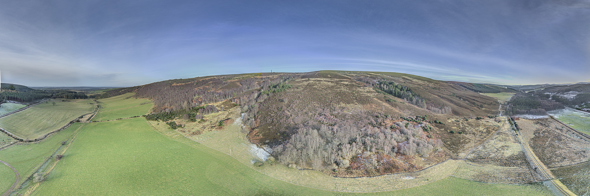
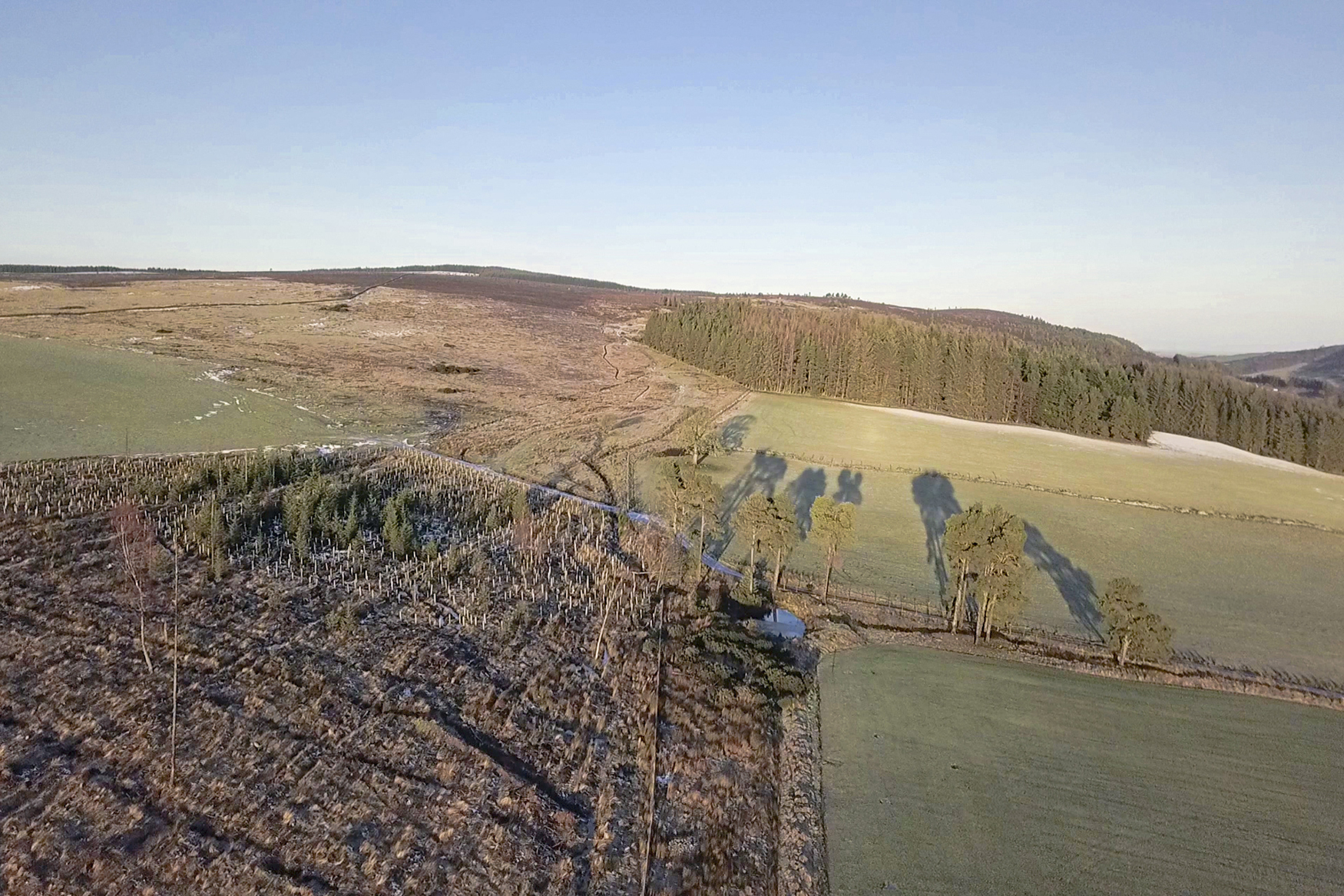
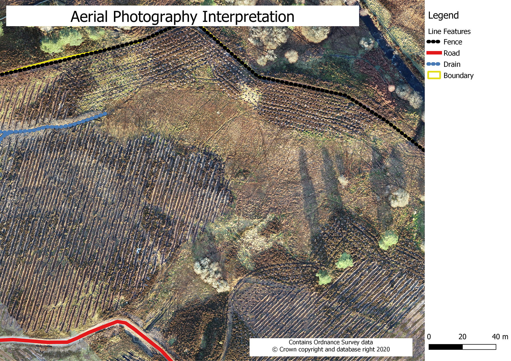
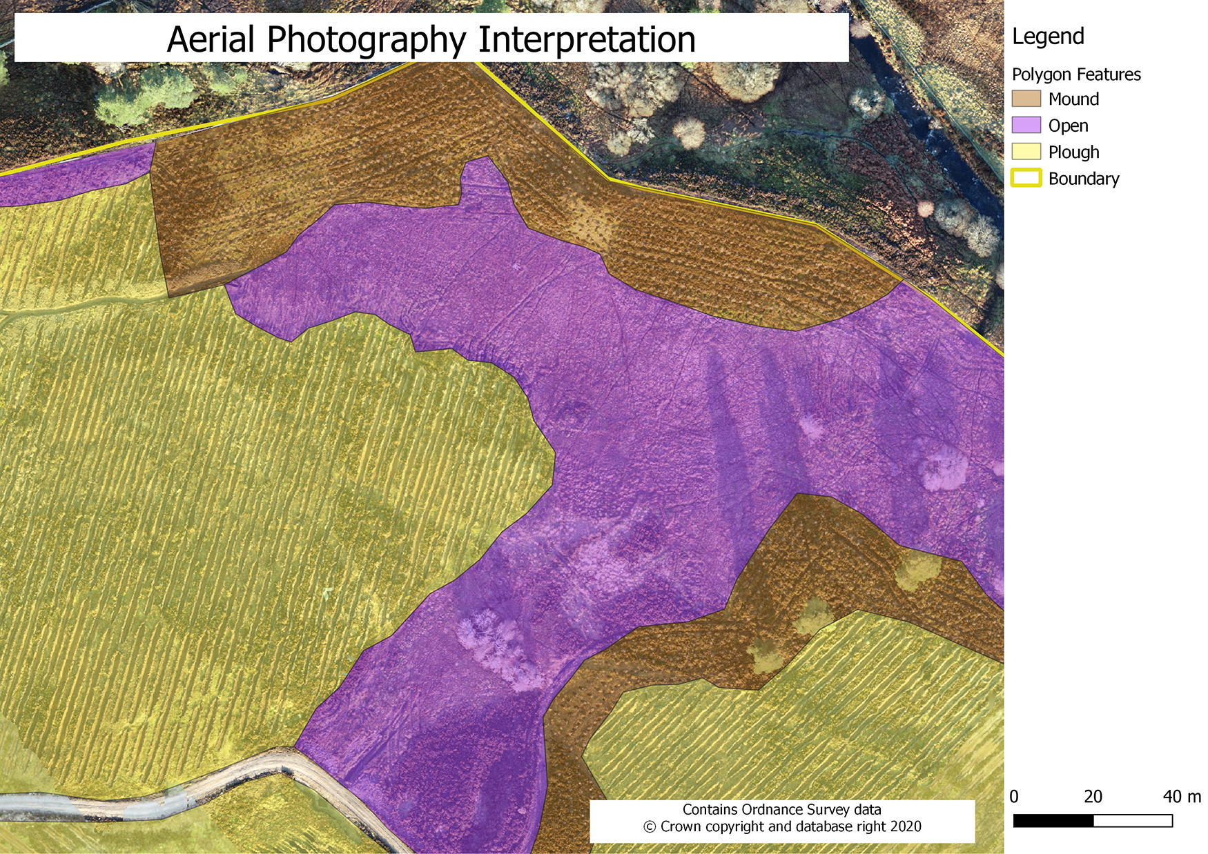
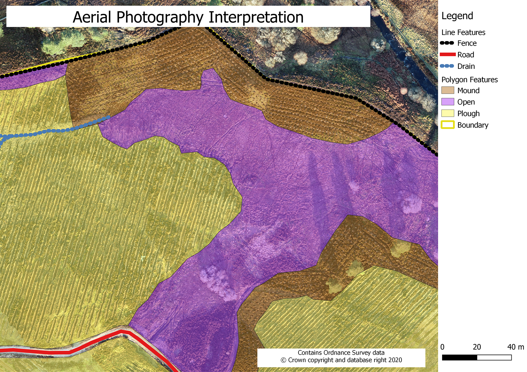
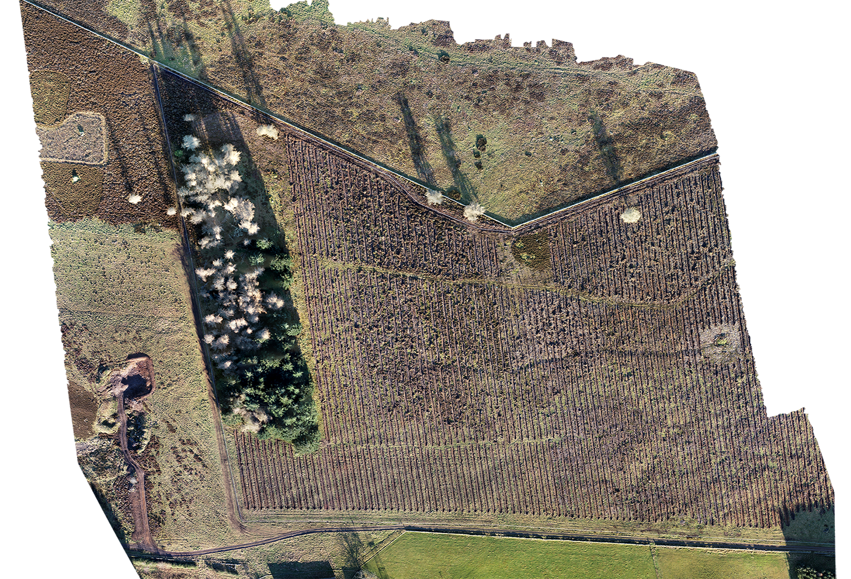
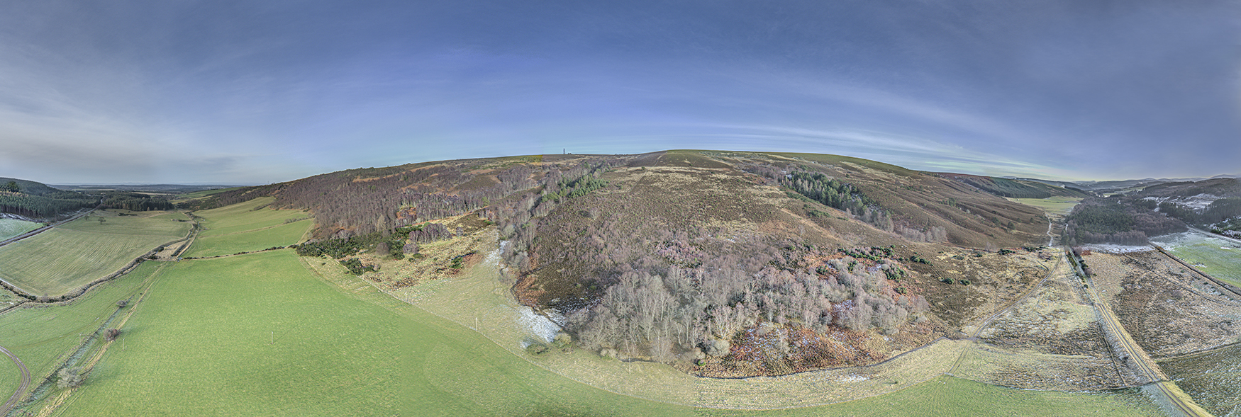
Drone Surveys
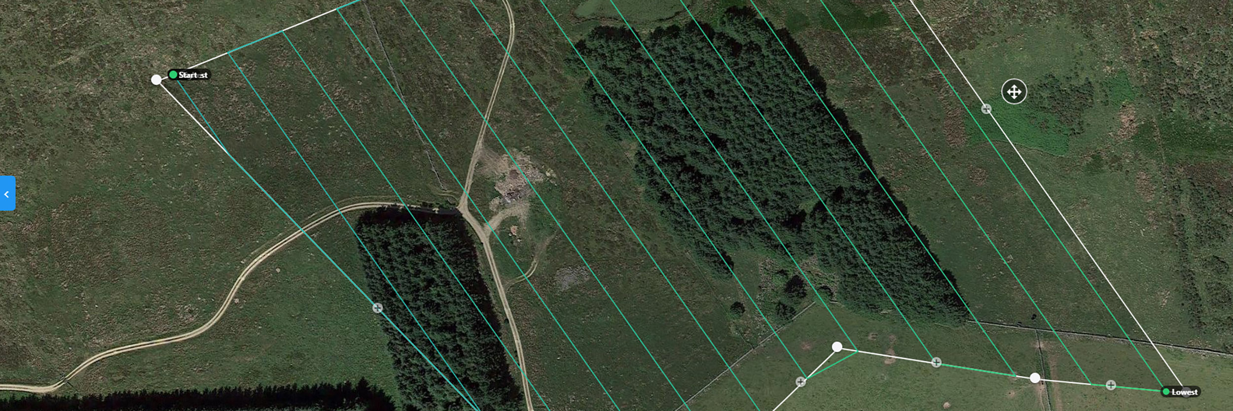
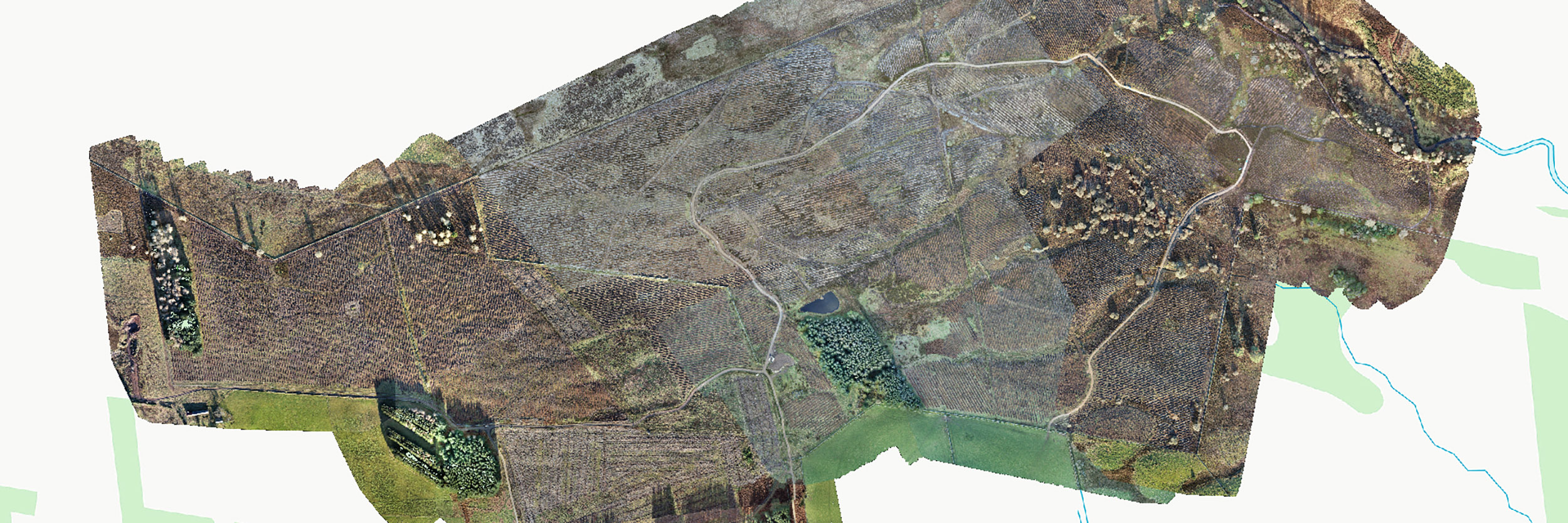
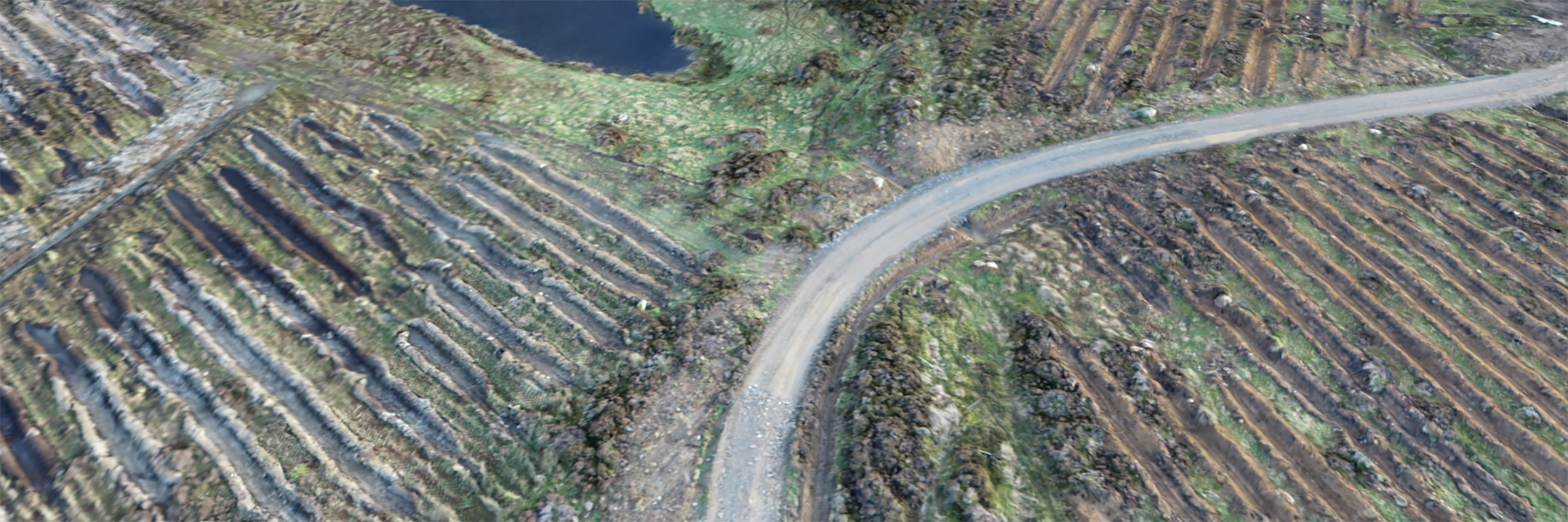
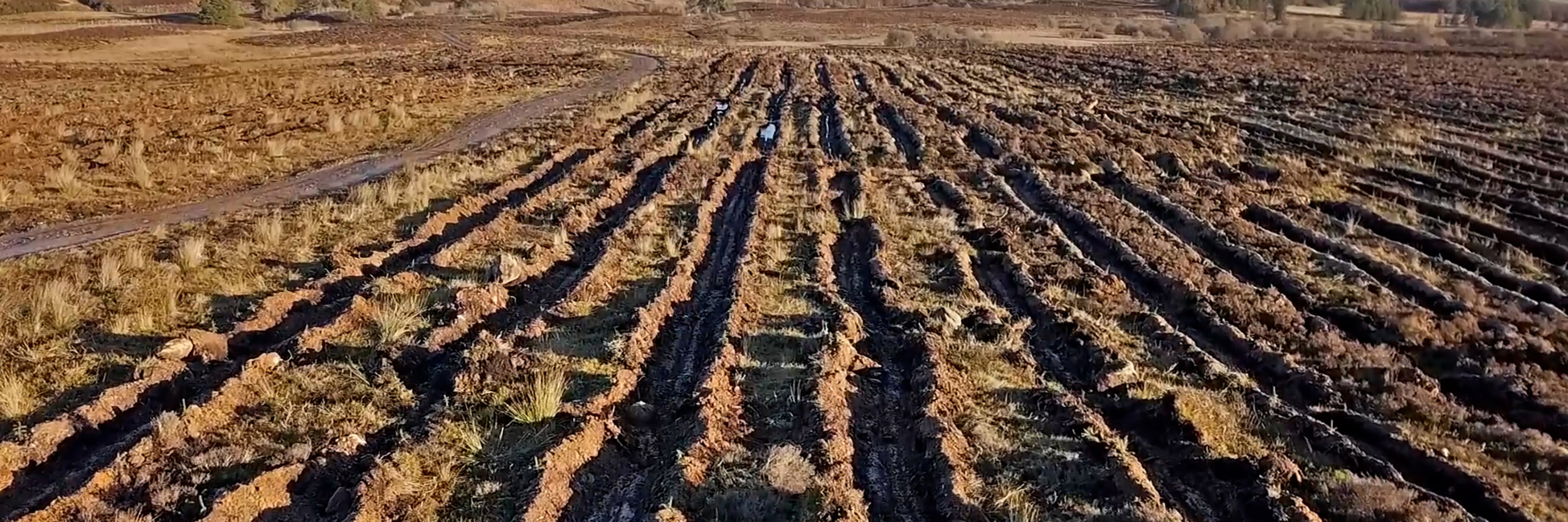
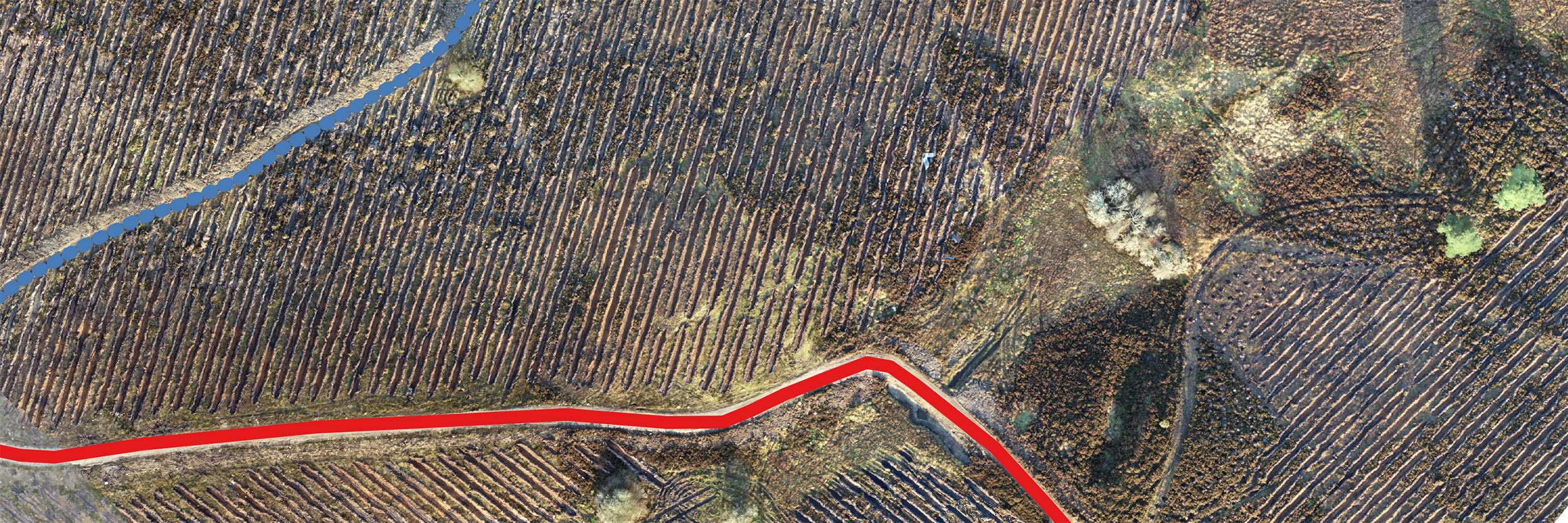
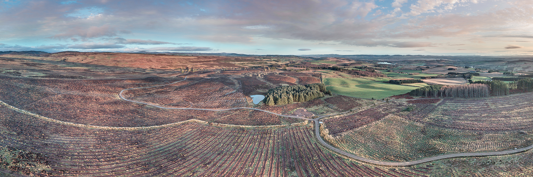
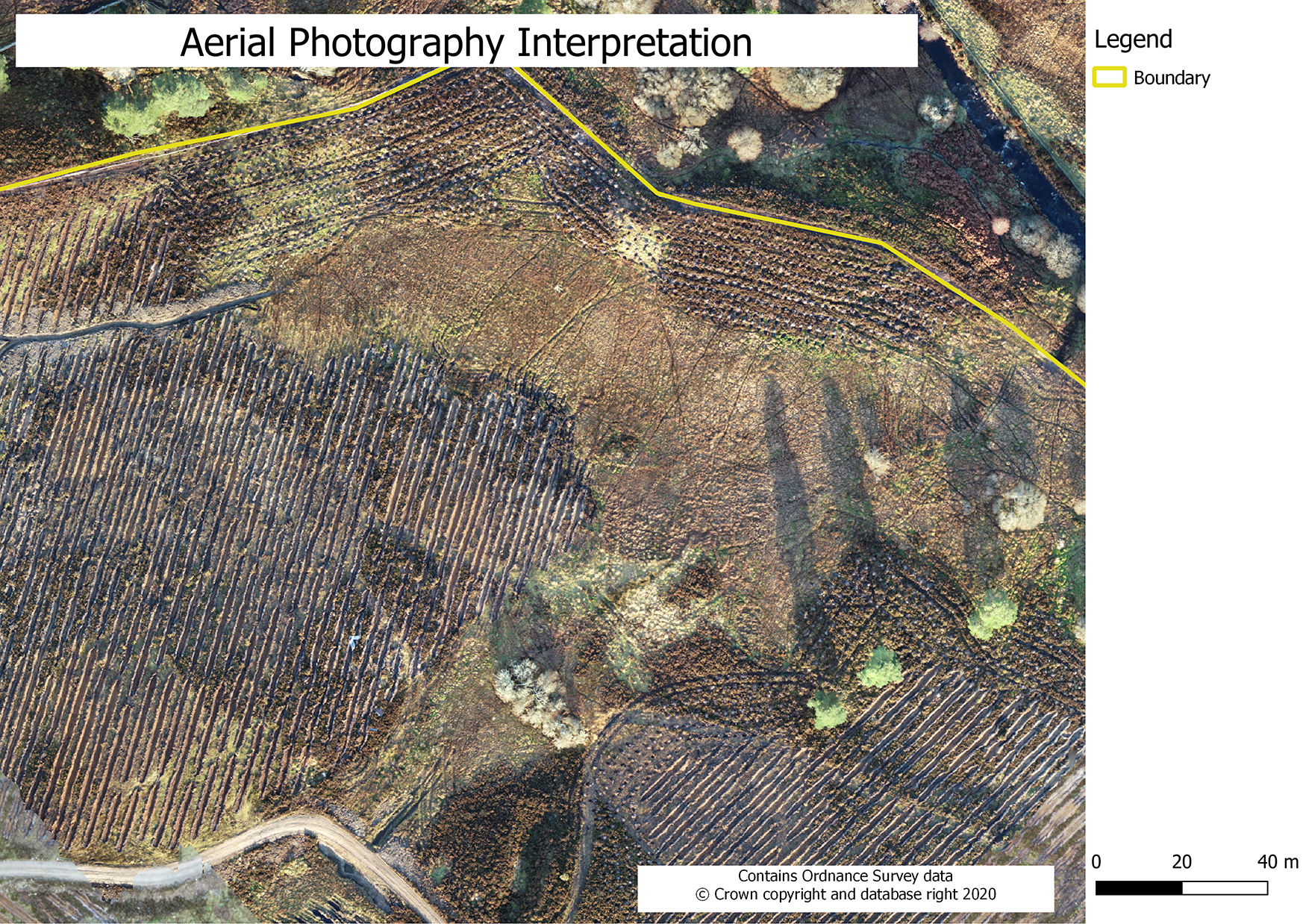
The completed drone survey of a 100ha commercial woodland creation project in Perthshire.
The survey comprises a series of autonomous flights which were processed and mosaiced into a final, composite orthorectified aerial image for the site. Final photography was calibrated using the GPS points captured by the drone against a series of Ground Control Points. This final quality control process ensured optimum accuracy.
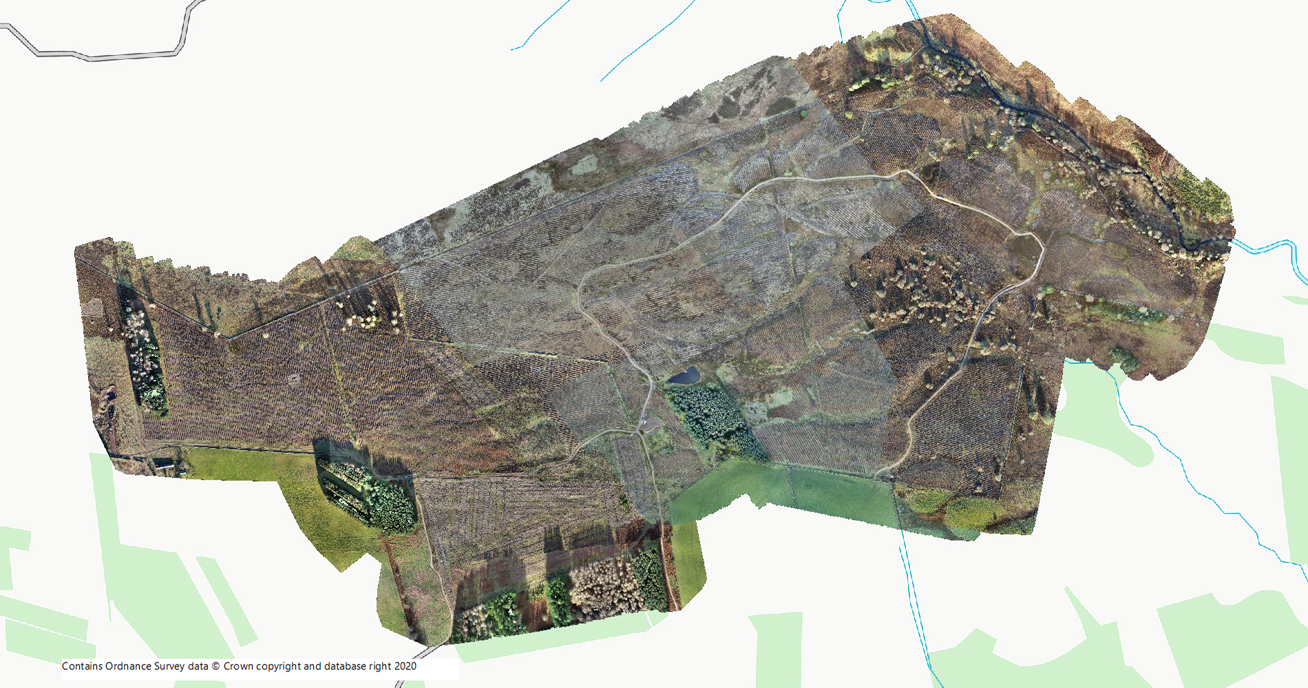
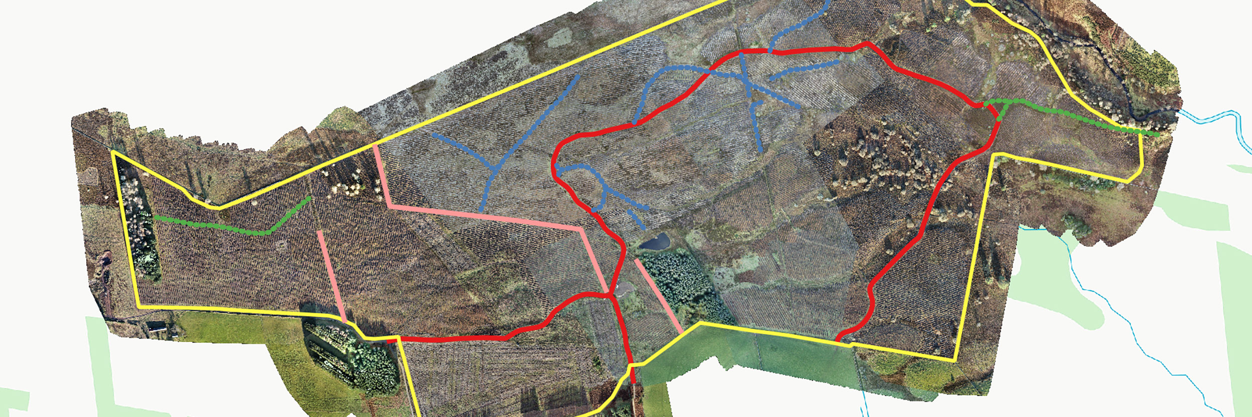
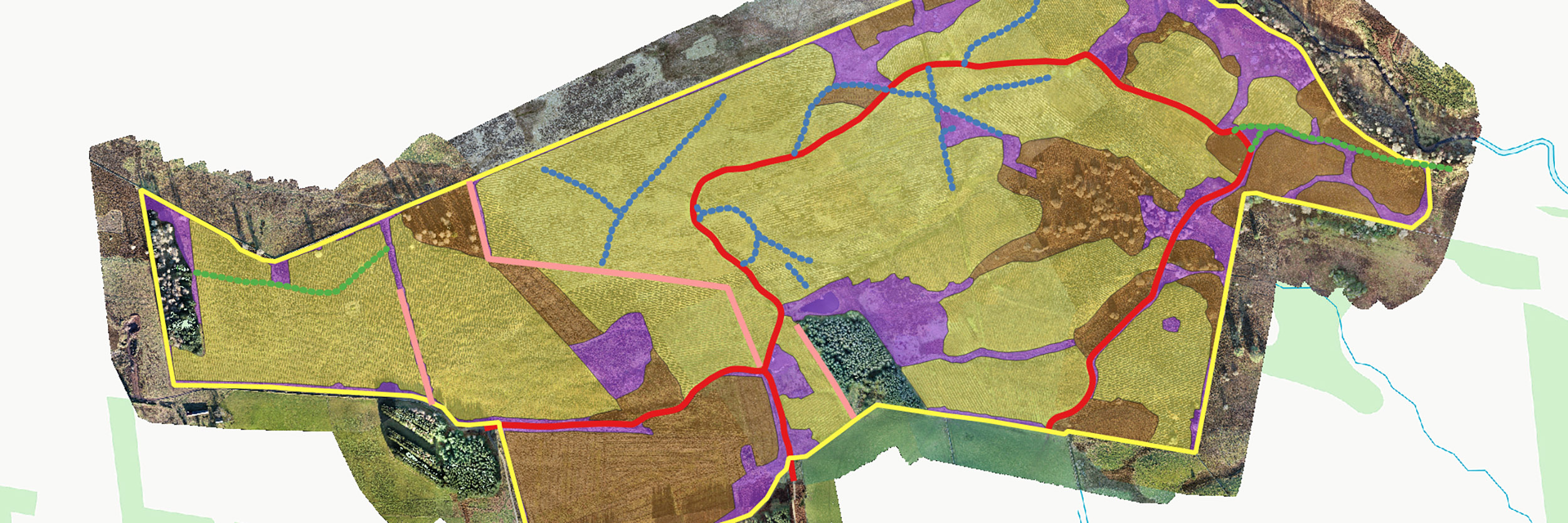
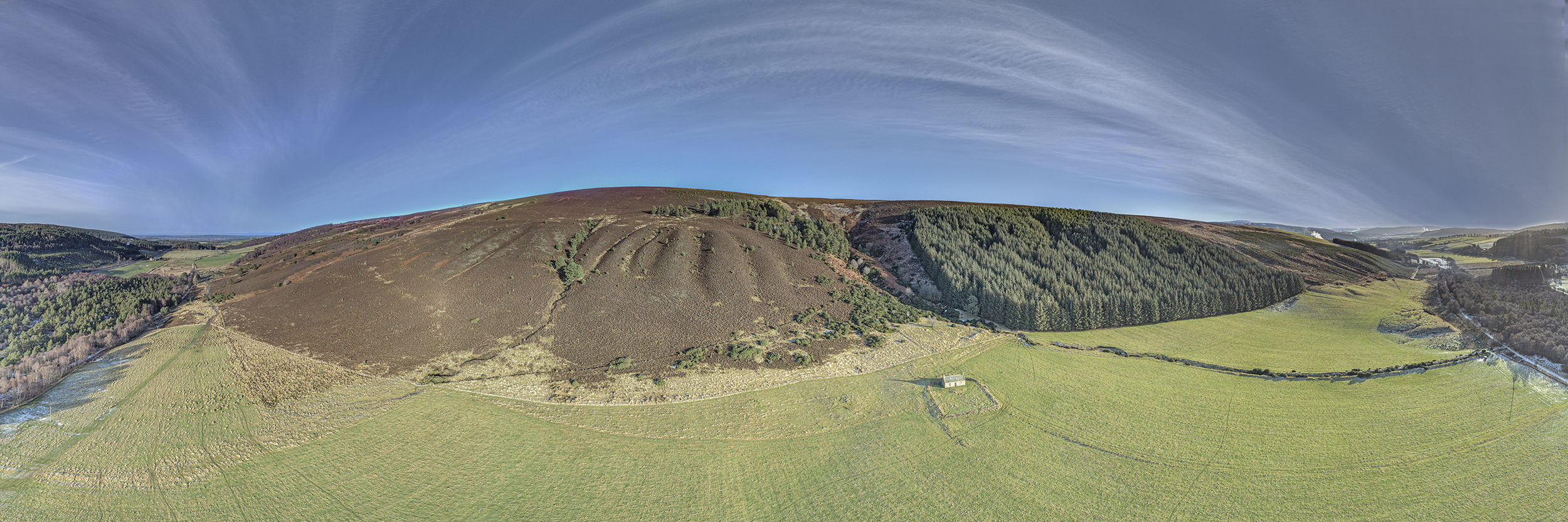
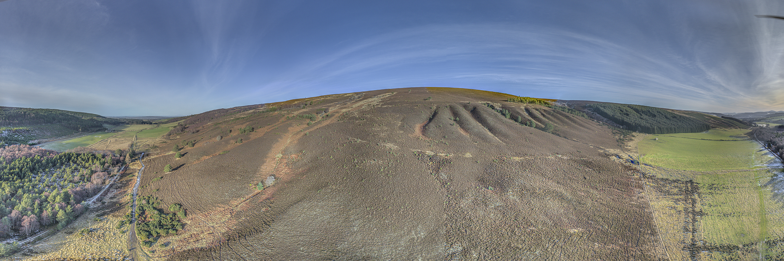
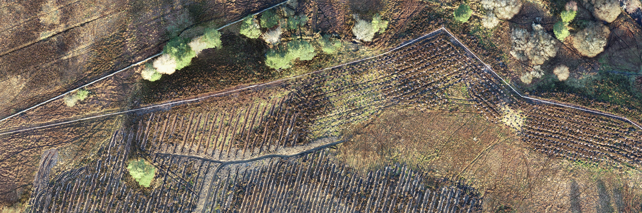
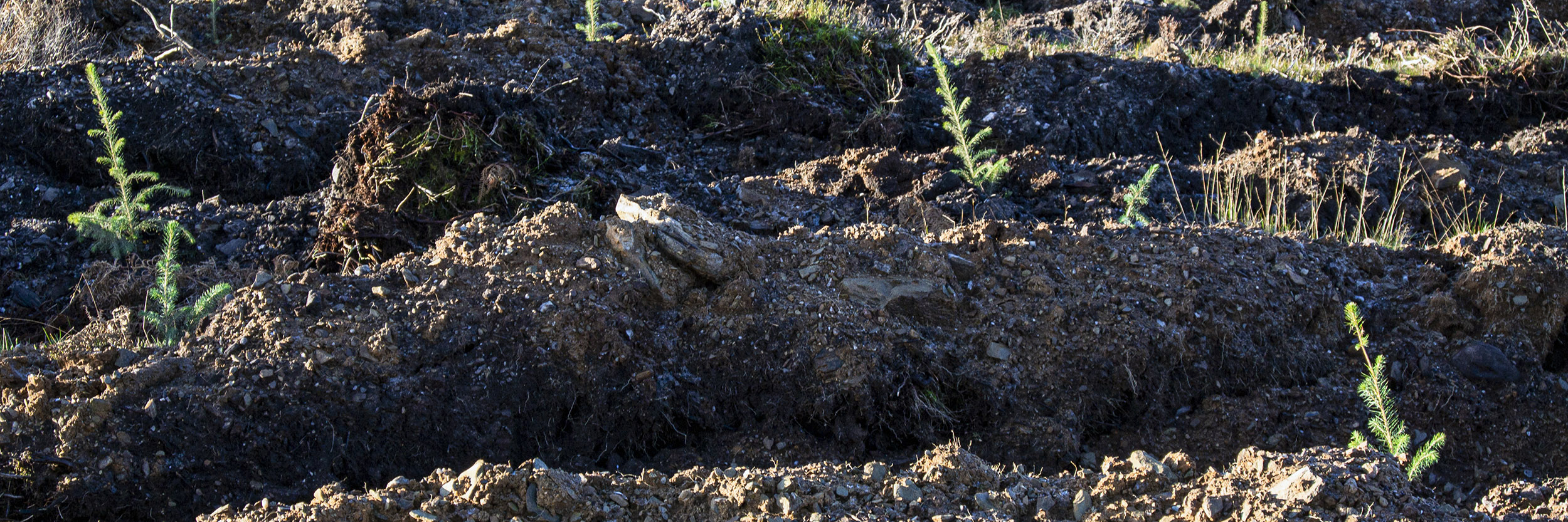
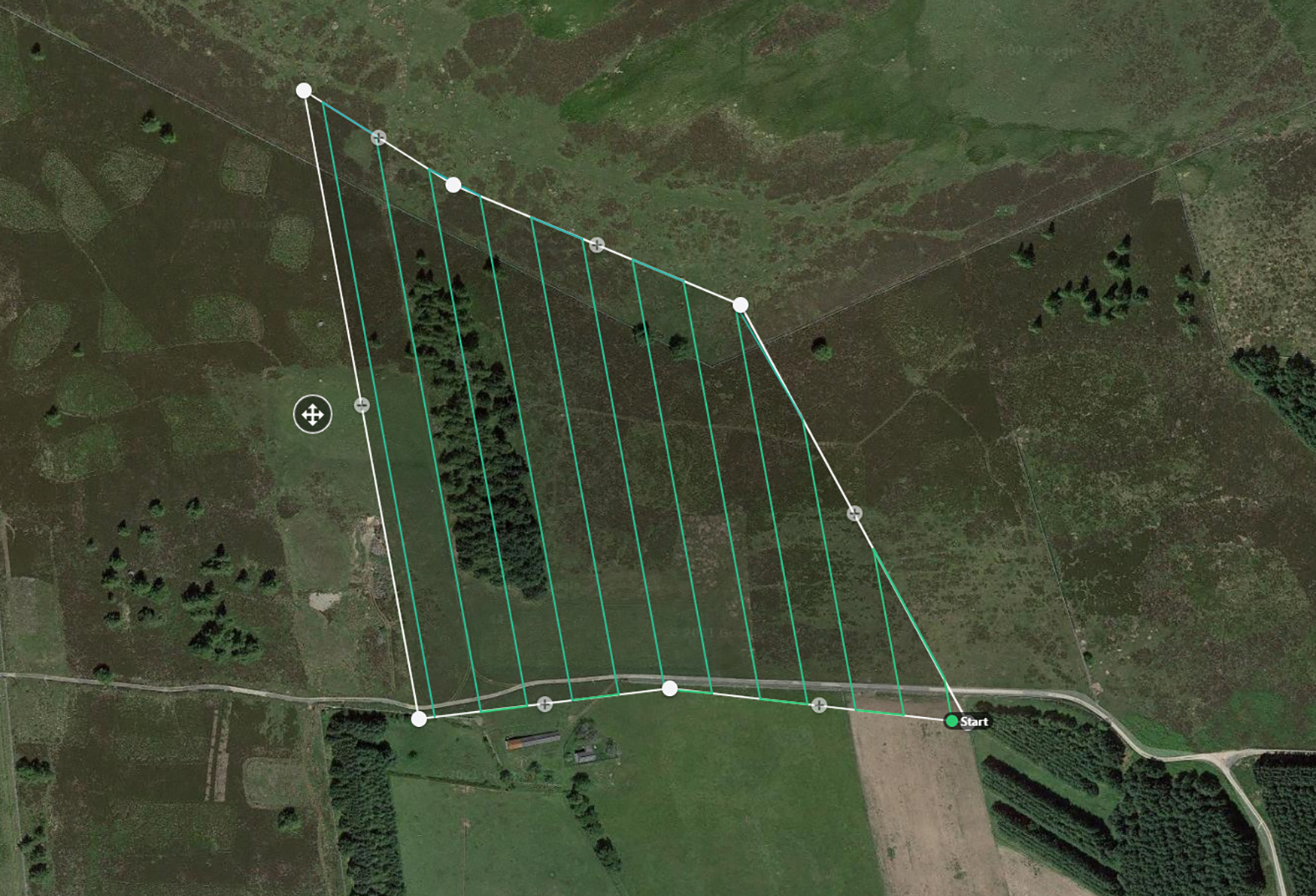
Drone Mapping
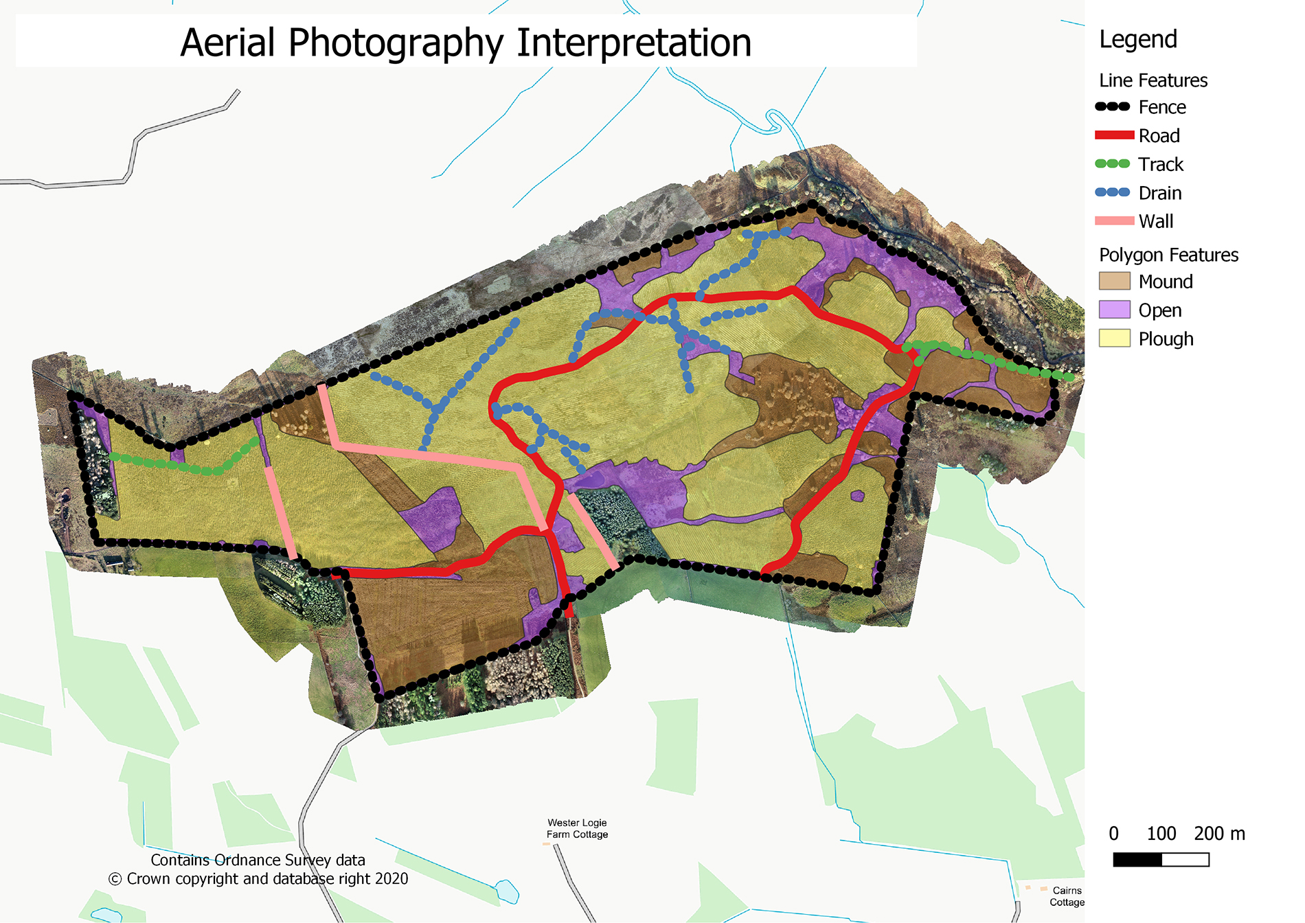
Drone Capabilities
Drones have many other applications in addition to aerial photography and surveying, including the capture of video sequences, 360° aerial panorama, photographs for use in 3D modelling and thermal image capture. Combining the wider application of drone capabilities with creative outputs can provide unique, interactive perspectives for interpretation, marketing and showcasing sites, landscape features and areas of special interest.
I have presented a summary of results from previous work below. These demonstrate some of the additional, interactive outputs available using drone technology and post processing of data using specialist software packages.
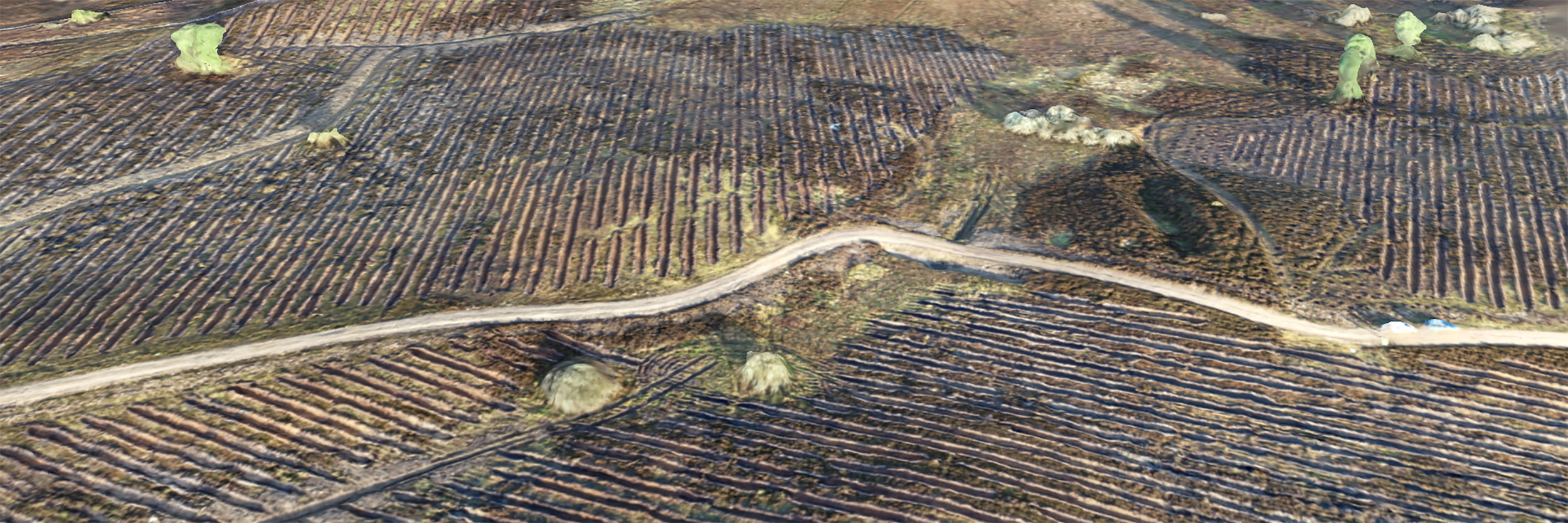
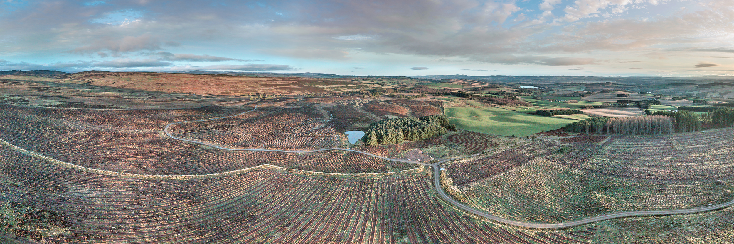
Acquisition Surveys
I used a combination of video and panoramic photography to capture a large scale, fly-over survey of a potential acquisition. Key components included:
Roading Access Ground vegetation Exsiting woodland cover Slope Adjacent landscapes
Using two drones I captured a series of oblique photographs as well as video footage of the site from several different perspectives. I also captured a series of panoramic images to highlight the scale of the acquisition and to provide views of the larger scale composition of existing woodland and ground available for planting.

Aerial Video
Three examples of aerial video capture are provided below. These are best viewed in high resolution and can be viewed in full screen mode directly from this page.
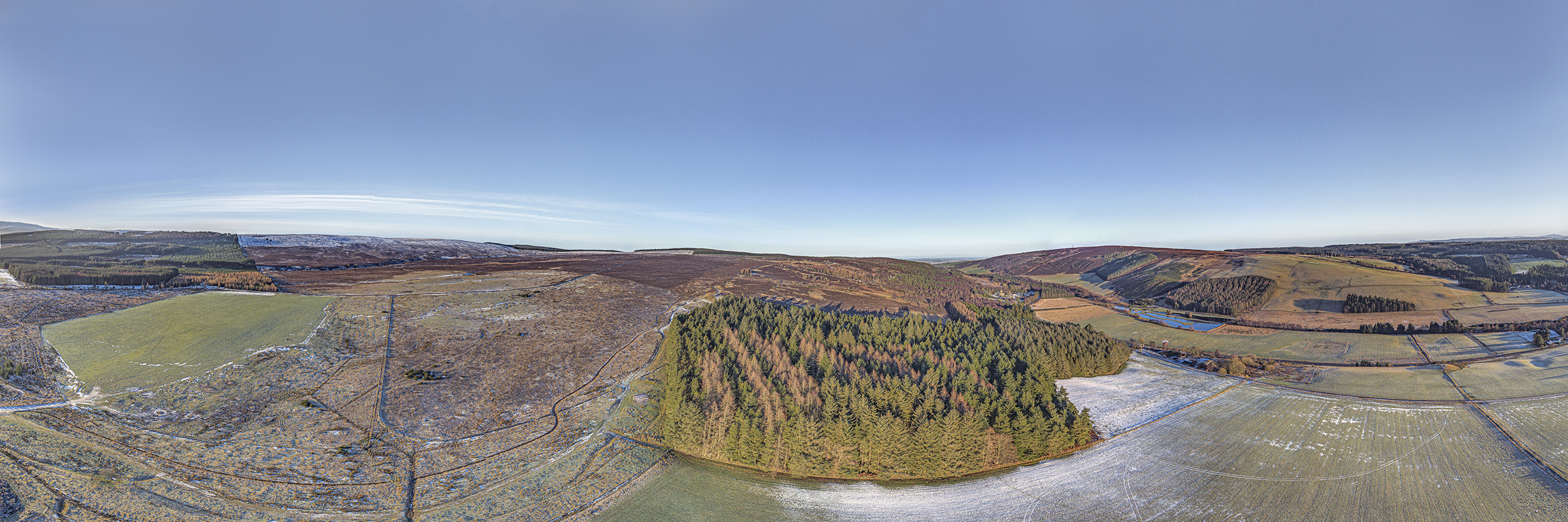
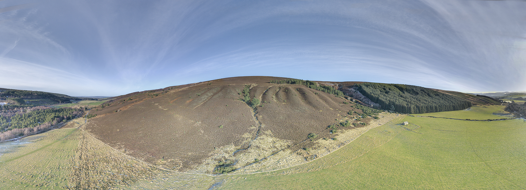
360° Panoramic Photography
Three examples of aerial video capture are provided below. These are best viewed in high resolution and can be viewed in full screen mode directly from this page.
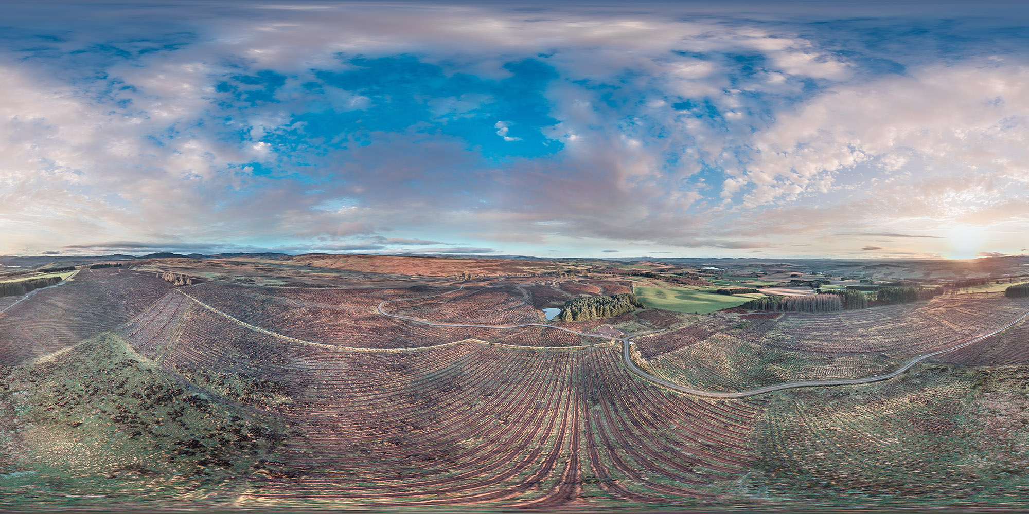
This composite image was captured using the drone, some 80m above the ground. I have rendered this into a high resolution, interactive 360° aerial panorama which also has a number of "hotspots" embedded into it.
Use the button below to open the full panorama and explore the site, the embedded images and the video clips.
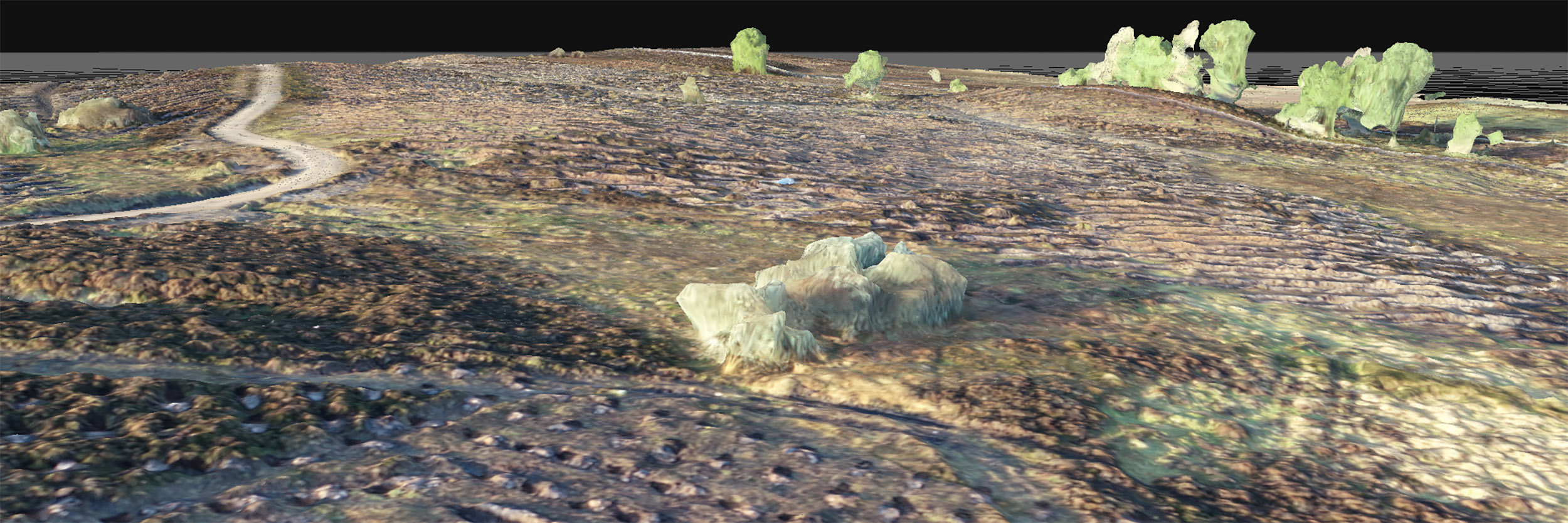
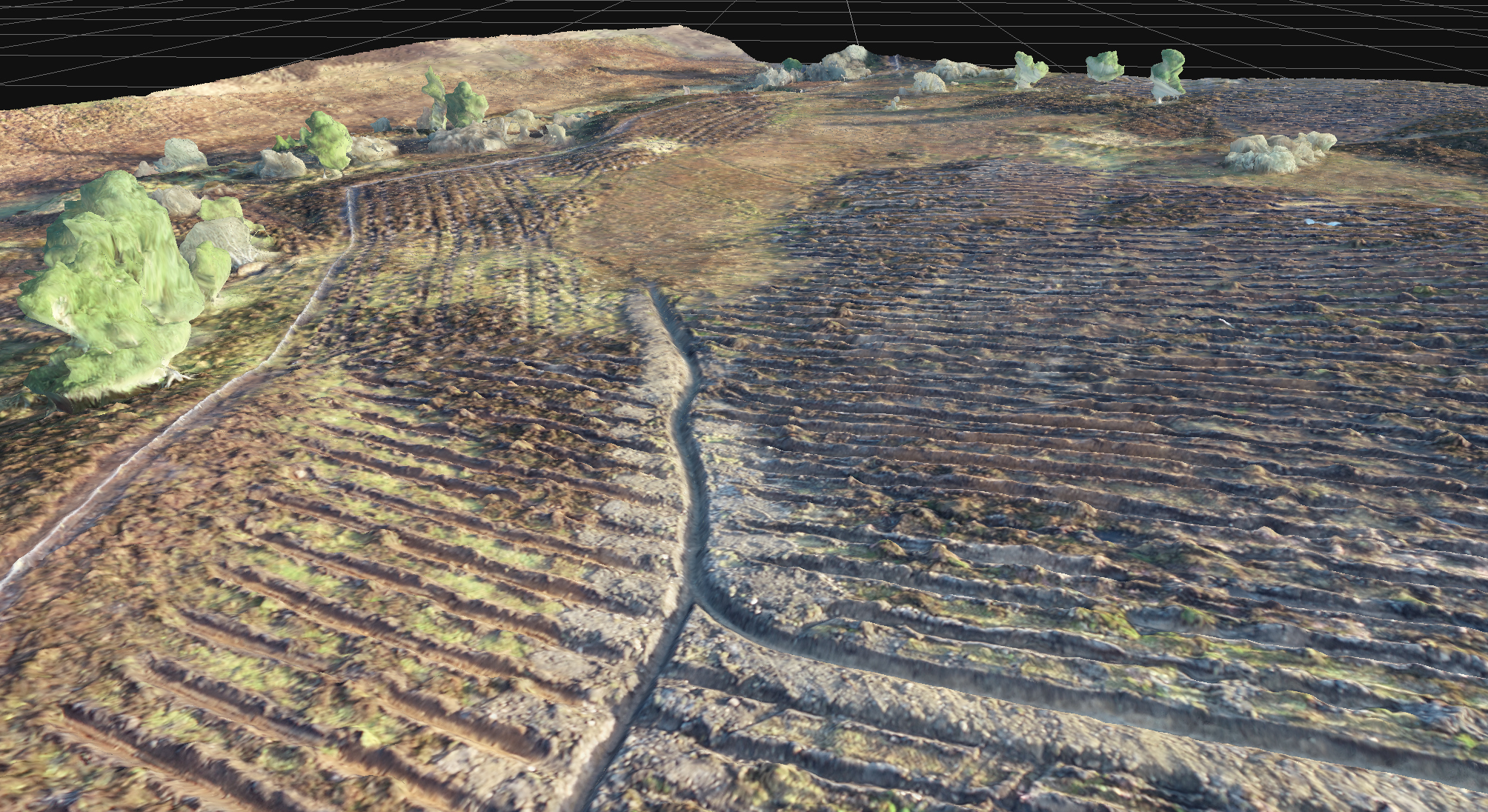
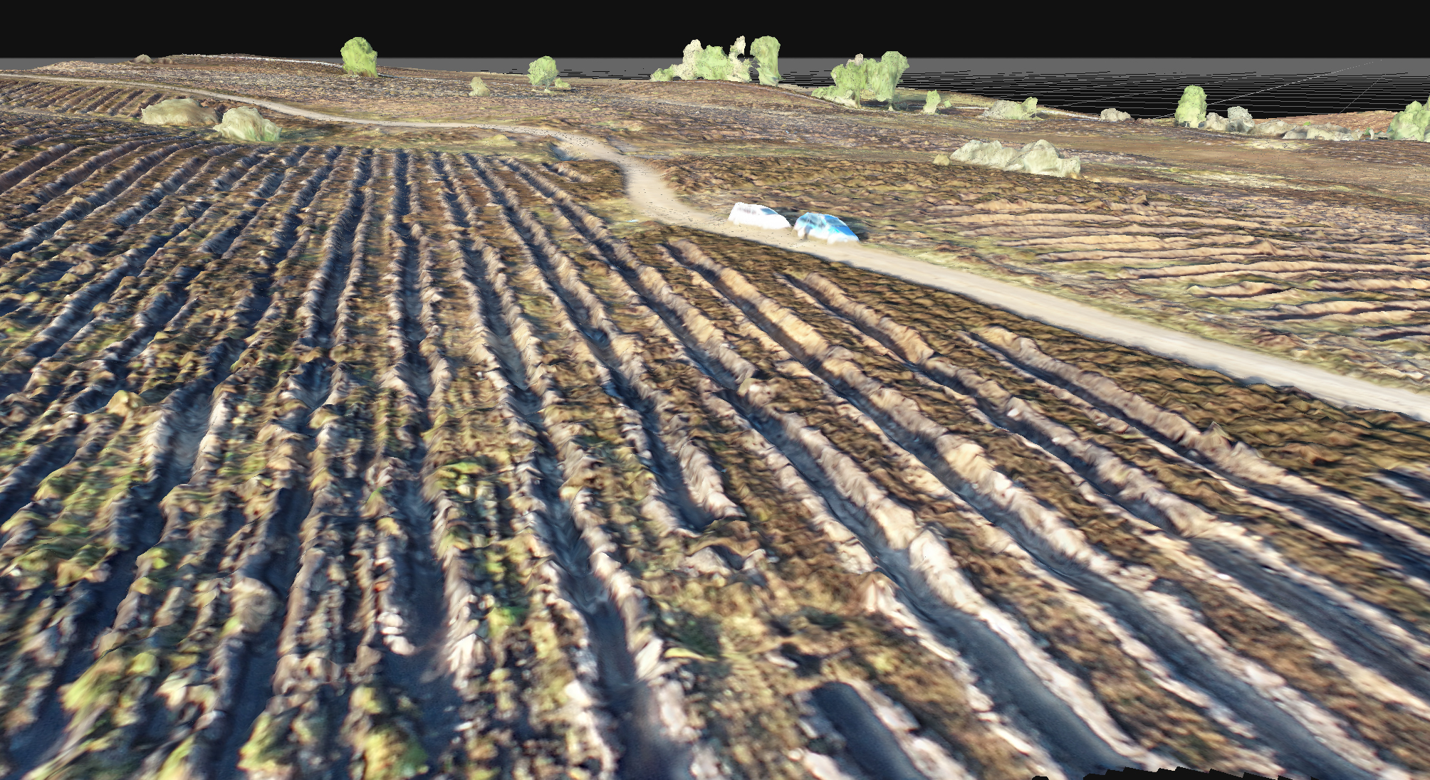
3D Modelling
Drones are increasingly being used for specialist 3D modelling and visualisation using photogrammetry techniques. The models capture details and features of buildings, landforms or landscape objects, all of which are geolocated to a high degree of accuracy and can be viewed three dimensionally.
I am still in the development stage of this technology but have included screen shots of 3D modelling of a recent project which provide visual examples of static output. I was successful with grant aid for the purchase of specialised 3D modelling software and the next stage in the development of this application is to refine the technique to allow orbital viewing of features of interest as well as 3D fly-throughs at a landscape based scale.
Thermal Capture
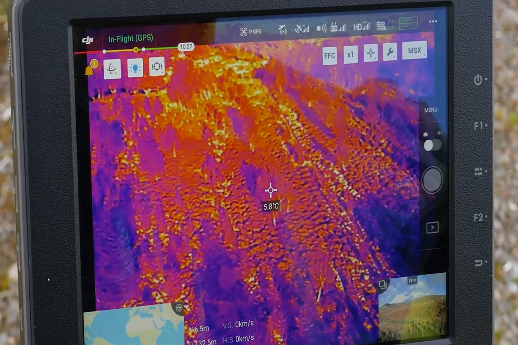
An incursion of Sika deer into a rewilding project woodland near Fort Augustus required a deer drive to move the deer out of the enclosure and back onto the hill ground. In planning the day, the suggestion was made to use a drone with a thermal camera in order to spot the deer in the woodland and to monitor their movements during the drive. This was a highly experimental use of a drone and, having been commissioned as the pilot for the day, I hired a drone with a high resolution thermal camera.
An initial reconnaisance with the drone, the day before the drive, identified both the location and approximate numbers of deer. This information was used the following day to help with the planning of the drive.
Whilst the deer were ocasionally spotted by eye and often picked up by the optical camera on the drone, the real advantage to the exercise was being able to count the deer using the thermal camera. This allowed for an accurate estimation of the numbers of deer driven out of the woodland whilst also providing an indication of numbers remaining. The drive was largely successful and, as you will see, was filmed by Roland Arnison of Mallimak Producutions. Watch the film to find out more...
For more information or to discuss potential projects, please call: 07780 787034 or email:
angus@scotland360.co.ukAngus Mackie
Birchmill House, Culbokie, Dingwall, IV7 8JH